What is a watershed?
Ancaster Creek is more than just a creek. Like any river, stream, or lake, it is part of a larger watershed. Watersheds are composed not only of the watercourses that flow through them, but also all the surrounding lands that feed those watercourses with the precipitation that falls on them. Ancaster Creek is part of the larger Spencer Creek watershed, which flows through much of Hamilton and the surrounding areas into Lake Ontario through the Coote’s Paradise wetland. Eventually, this water passes through the St. Lawrence River into the Atlantic Ocean. Watersheds are deeply interconnected systems, and changes upstream can affect communities and ecosystems many kilometres downstream. Therefore, it is important to restore and protect all the components of a watershed: both aquatic and terrestrial. McMaster University are stewards of multiple properties within the Ancaster Creek subwatershed, such as the McMaster Forest Nature Preserve and McMaster University Lower Campus. McMaster University also collaborates with other stewardship organizations to ensure a healthy watershed for all.
What are coldwater creeks?
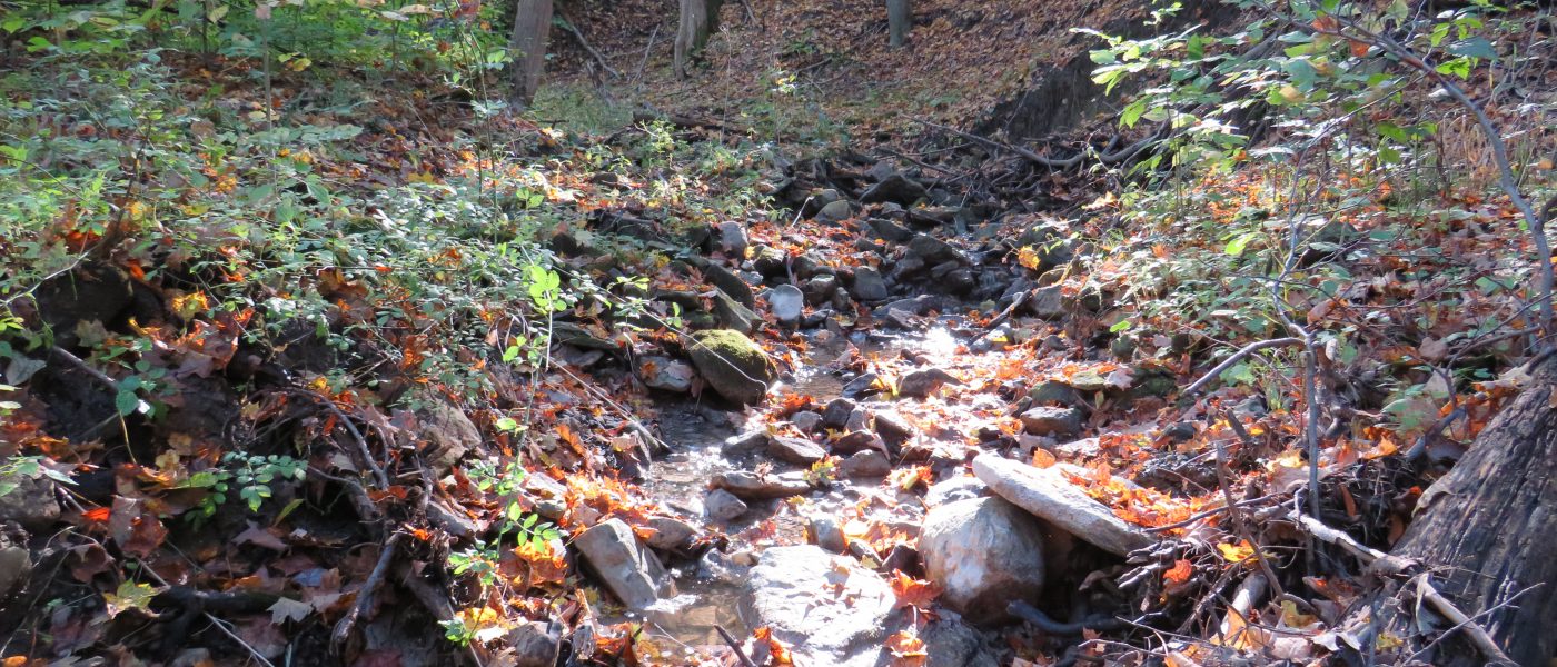
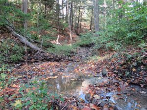
One aspect of Ancaster Creek that gives it unique ecological significance is its historical status as a coldwater creek (Ancaster Creek Subwatershed 2013). Coldwater creeks are creeks that maintain a cool temperature year-round due to the temperature of groundwater feeding the stream and shade provided by overhanging vegetation. These creeks are crucial components of watersheds as they help to regulate water temperature downstream. Colder temperatures and the higher oxygen levels they are associated with also provide a rare aquatic habitat that numerous fish species depend on for survival (Ancaster Creek Subwatershed 2013; Our programs 2018). Brook Trout, the only native salmonid species to the Hamilton area, requires healthy coldwater creeks to reproduce (Our programs 2018). Ancaster Creek once provided healthy habitat for this rare species, but they have since been extirpated. However, Rainbow Trout (an introduced species) has been found in Ancaster Creek, suggesting it still remains healthy enough to support coldwater species (Ecology 2023). Maintaining healthy terrestrial habitats along Ancaster Creek is crucial to ensuring it remains a healthy coldwater creek and can continue to support the species that rely on it. Without sufficient vegetation along the creek banks, Ancaster Creek would lose its coldwater status due to exposure to heat from the sun. The Nature at McMaster team has been working on conserving the creek by planting trees along its edges to ensure it remains shaded and healthy.
What threats are faced by the Ancaster Creek subwatershed?
The Ancaster Creek subwatershed faces a number of threats from human activity in the area. Healthy watersheds in Southern Ontario require healthy forests and wetlands, as well as permeable surfaces for groundwater to move through (Ancaster Creek Subwatershed 2013). Development in watersheds not only reduces the amount of healthy habitat, but also increases impermeable surface area by creating new paved areas like roads and parking lots. Buildings that send rainwater directly into stormwater drains instead of into the soil also prevent the storage of this precipitation as groundwater. Other threats facing the Ancaster Creek subwatershed are stormwater and Combined Sewer Overflows (CSOs), degradation of terrestrial habitat and riparian barriers, erosion, and pesticide use, among others (ACT! STEWARDSHIP ACTION PLANS 2007).
When problems occur in the City of Hamilton’s sewer system or when stormwater exceeds the system’s capacity, pollutants may be discharged into local watercourses (Government of Canada 2013). These pollutants can have devastating impacts on aquatic and terrestrial ecosystems and are one of the foremost threats facing the Ancaster Creek subwatershed (ACT! STEWARDSHIP ACTION PLANS 2007; Hristova, 2021). Another threat facing Ancaster Creek is the degradation of surrounding terrestrial habitat and riparian barriers. Healthy streams require healthy land to reduce erosion and flooding and to filter out contaminants in the water. Plants adapted to live alongside streams are well-equipped to fulfil both requirements, but they require healthy habitat to survive. Development that encroaches on watercourses like Ancaster Creek degrades the health of the surrounding habitat, and leads to more flooding, erosion, and pollution (Riparian Area Management 2020). Because of the interconnectedness of watersheds, erosion and pollution upstream can have drastic effects on the health of the ecosystems downstream, and so protecting the entire watershed through co-operation between governments, organizations, and private landowners is crucial.
What are riparian barriers?
As described by Hilliard and Reedyk of Agriculture and Agri-Food Canada, riparian barriers are “strip[s] of moisture-loving vegetation growing along the edge of a natural water body” (2020). Riparian barriers are not only the vegetation growing immediately beside a stream bank, but when healthiest extend multiple meters away on both sides to achieve the most possible benefits (Hilliard & Reedyk, 2020; Riparian Forest Buffers). Riparian barriers are invaluable components of a healthy watershed, as they provide vital ecosystem services. Vegetation in riparian barriers hold stream banks in place via their roots, providing stability and reducing erosion. Riparian vegetation also captures sediments carried by the stream which, combined with erosion control, maintains a healthy balance of sediment and nutrient load in the water. Additionally, riparian vegetation creates a diversity of micro-habitats in streams, such as deeper pools or tangled roots, for aquatic species to use. Furthermore, the shade produced by riparian vegetation reduces algal growth, which can choke streams and prevent fish and other species from travelling through waterways when left unchecked. Riparian barriers provide substantial flood control as well, by reducing stream velocity and slowing the hydrological response to large precipitation events (Hilliard & Reedyk, 2020). In summary, riparian barriers are an exceptionally valuable and indispensable part of a healthy watershed and are essential to the conservation of Hamilton’s waterways.
Expandable List
- Re-establish riparian buffers where there are none and increase the width of existing riparian buffers.
- Plant native trees, shrubs and herbaceous plants in front, rear and side yards.
- Disconnect downspouts that direct water from roofs and eavestroughs to the storm sewer system and direct them to yards and gardens.
- Consult with a Hamilton Conservation Authority Stewardship Technician for ways to reduce the negative impacts on creeks caused by on-line ponds.
(Taken from the HCA’s Ancaster Creek Subwatershed Factsheet)
Recreation in the Ancaster Creek Subwatershed
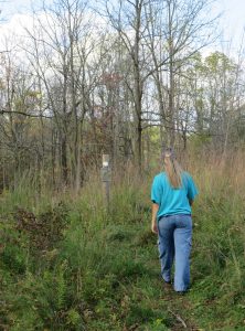
The Ancaster Creek subwatershed provides a beautiful diversity of habitats to explore, and there are multiple trail networks in the area to facilitate your enjoyment. The McMaster Forest Nature Preserve is home to a variety of meadow, forest, and ravine habitat types that host many unique species such as Eastern Bluebird and Eastern Milksnake. The Hamilton Conservation Authority also oversees natural areas in the subwatershed, including the scenic Tiffany Falls. The City of Hamilton and the Bruce Trail Conservancy also manage lands with trail systems within the Ancaster Creek subwatershed.
When using any nature recreation trail, please be sure to follow all rules established by the relevant authorities. Remember, a good policy for any recreational activity in nature is “take only pictures, leave only footprints”. It is important to respect both our local ecosystems as well as the work done by passionate volunteers and organizations to conserve them.
Works Cited:
Beeton, A. M. (2023). Physiography of Great Lakes. Encyclopædia Britannica. https://www.britannica.com/place/Great-Lakes/Physiography
Government of Canada. (2013, July 25). Government of Canada. Canada.ca. https://www.canada.ca/en/environment-climate-change/services/wastewater/resource-documents/science-assessment-impacts-municipal-effluent.html#CSOs
Government of Canada. (2020, July 29). Riparian Area Management. agriculture.canada.ca. https://agriculture.canada.ca/en/agricultural-production/soil-and-land/riparian-area-management
Hamilton Conservation Authority. (2007). ACT! STEWARDSHIP ACTION PLANS. Hamilton Conservation Authority. https://conservationhamilton.ca//opt/vhosts/nature.mcmaster.ca/www/web/app/uploads/2015/07/08May1_ACT_SAPs_Part1_FINAL.pdf
Hamilton Conservation Authority. (2013). Ancaster Creek Subwatershed. Hamilton Conservation Authority. https://conservationhamilton.ca//opt/vhosts/nature.mcmaster.ca/www/web/app/uploads/2018/04/Ancaster-Creek-Factsheet-2018.pdf
Hamilton Conservation Authority. (2022, August 4). Hiking & Recreational Trails. Hamilton Conservation Authority. https://conservationhamilton.ca/hiking-trails/
Hilliard, C., & Reedyk, S. (2020, July 29). Riparian Area Management. Agriculture and Agri-Food Canada. https://agriculture.canada.ca/en/agricultural-production/soil-and-land/riparian-area-management
Hristova, B. (2021, April 14). Royal Botanical Gardens says “considerable sewage” still spilling into Cootes Paradise. CBCnews. https://www.cbc.ca/news/canada/hamilton/algae-sewage-princess-point-1.5985834
Nature @ McMaster. (2023, July 19). Ecology. Nature @ McMaster. https://nature.mcmaster.ca/mcmaster-forest/ecology/
USDA Forest Service. (n.d.). Riparian Forest Buffers. USDA Forest Service. https://www.fs.usda.gov/nac/practices/riparian-forest-buffers.php
Watersheds Canada. (2018). Our programs. watersheds.ca. https://watersheds.ca/our-work/habitat-programs/cold-water-restoration-projects/waddle-creek/