The Hamilton area has a rich history, to which McMaster Forest is no exception. Prior to European contact the area was inhabited and used by Indigenous peoples for thousands of years and the property would have been covered in rich forests, swamps, and marshes. After the American Revolutionary War (1775 – 1783) the property and surrounding area was deeded by the British Crown. Over time, the forests were cut down for timber and cleared for farming. Farming continued at this site up until the mid 1950’s when the property was sold for potential development.
The hard-packed clay soil and poor drainage conditions made building difficult and the property was sold to McMaster University in two parts in 1964 and 1969, respectively. McMaster hoped that the area could be developed into an Ancaster satellite campus with a front entrance off Lower Lions Club Road and a private road to the north connecting the Ancaster satellite campus to McMaster’s main campus. This road would have run along what is currently Ancaster Creek/Coldwater Creek. Development was halted due to the difficult building conditions and environmental concerns from the university and governing bodies. The property would be largely unused by the university until 2012. In 1996 the northern portion of the property and much of the ravine land/floodplain was sold to the Hamilton Conservation Authority.
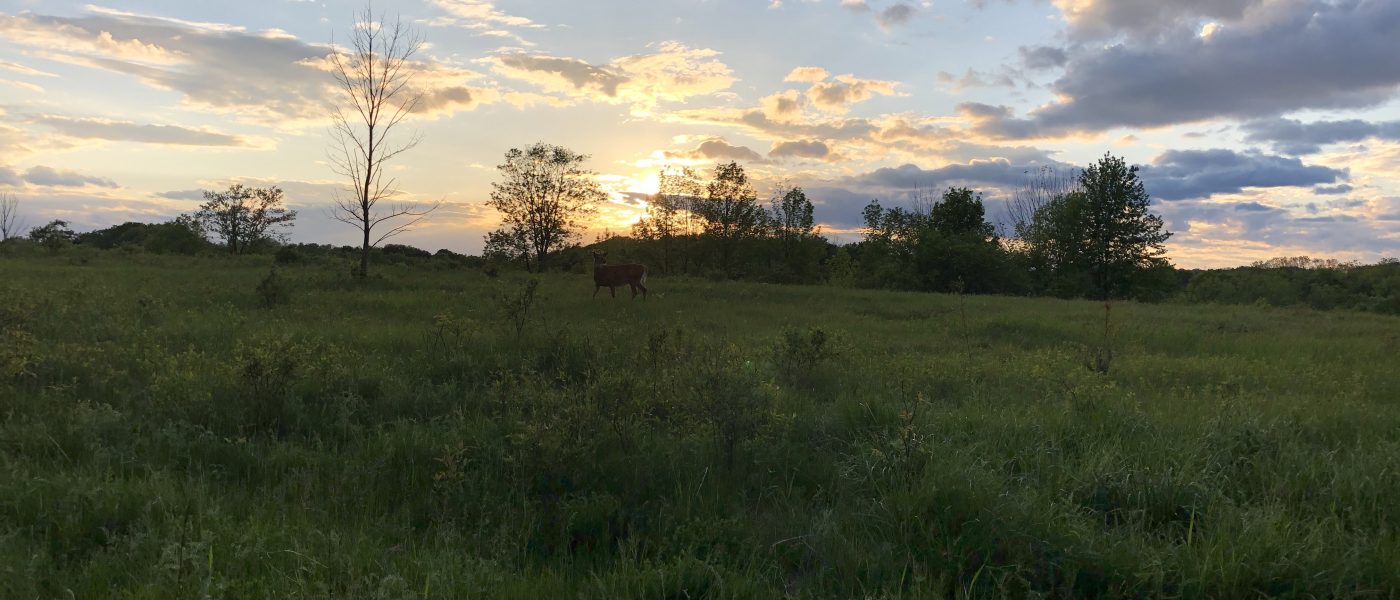
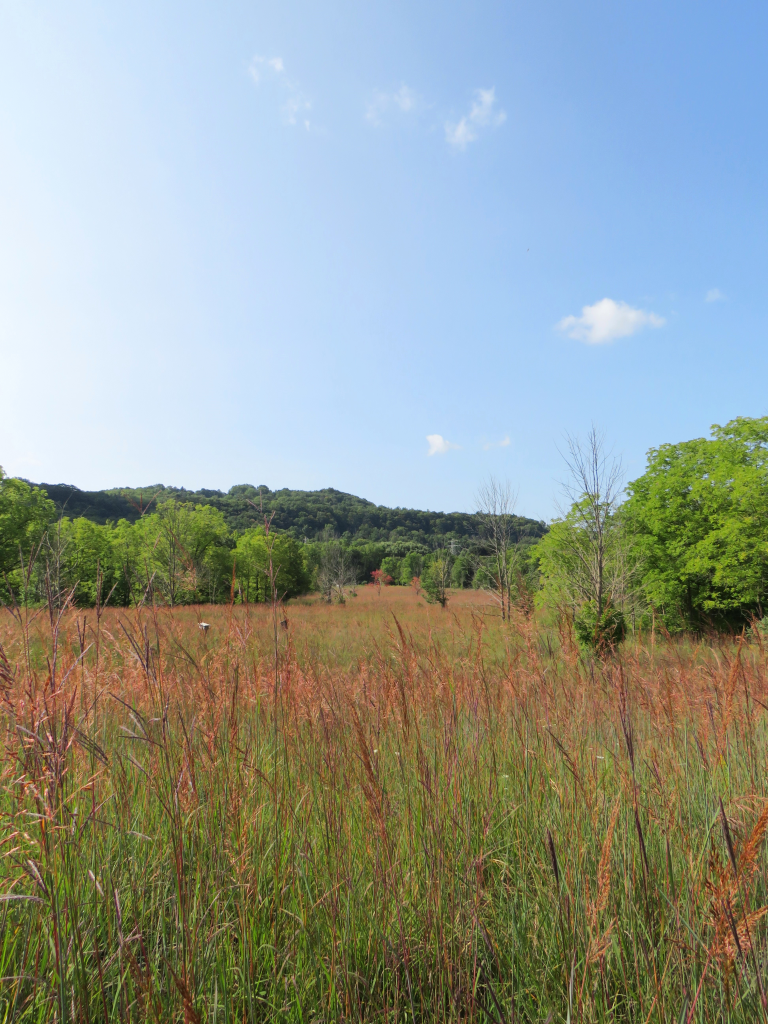
In 2013 and 2014 members of the McMaster Biology Department, university staff, and students worked to remove a large thicket of invasive European Buckthorn (Rhamnus cathartica) trees and turning the cleared area into tallgrass prairie habitat. Tallgrass prairie habitat used to be widespread across Southern Ontario but has dwindled to less than 3 percent remaining. This unique habitat type is home to a large biodiverse group of plants and animals. From 2013 to the present, the property has been widely used by undergraduate and graduate students, professors, and the public for research, teaching, and passive recreation purposes.
On October 22, 2015, the McMaster University Senate and Board of Governors officially designated the property as an area of environmentally significant natural land, to be used for ecologically sensitive teaching, research, and recreation purposes. On this same date they approved the official naming of the property as “McMaster Forest”. The property is now permanently protected and will continue to be an important place for research, teaching, enjoying stunning recreational trails, and incredible biodiversity.
Timeline
Indigenous peoples have inhabited the Hamilton area for at least the last eleven thousand years, according to archeological and historical evidence, and traditional cultural knowledge and teachings. The earliest recorded group was the Attiwandaronk (Neutral Nation) people, who were a confederation of Iroquoian tribes living in the area of Western Lake Ontario. French explorers were the first Europeans to encounter the Indigenous communities in the early 1600’s. In the mid 1650’s the Attiwandaronk people were defeated and displaced by the Iroquois Nations (Confederacy) who moved into the area. Remaining Attiwandaronk people were incorporated into the Seneca people. Later, the Mississauga people moved into the area. In 1701, the Anishinaabe (Ojibwe, Potawatomi, Odawa (Ottawa), Chippewa, Mississauga, Saulteaux, Nipissing and Algonquin people) and Haudenosaunee (Mohawk, Oneida, Onondaga, Cayuga, and Seneca people) Nations signed the Dish with One Spoon Wampum Agreement. The Wampum Agreement stated that the Nations would live in peace and share resources, such as hunting grounds. In the late 1700’s the British Crown purchased large areas of land from the Mississauga people. The land was to be offered to British Loyalists following the American Revolutionary War.
On December 1, 1798, the British Crown deeded Lots 51 & 52, Concession 1 in the Township of Ancaster to Michael Showers Jr.
Michael Showers (Jr.) was born in 1771 in Wyoming Valley, Luzerne, Pennsylvania. His parents were Michael (Sr.) and Hannah Schauer (later Showers). Michael Showers Sr. was a British loyalist; in 1778, he went to Niagara, Upper Canada, Quebec to fight with the British Army in the American Revolutionary War (1775-1783). Michael Showers Sr. would fight with the British up until the final year of the war.
In 1778, Michael Showers Jr., his six siblings, and his mother fled from Pennsylvania to the Machiche Loyalist Refugee Camp, Lower Canada, Quebec. In 1781, Michael Showers Sr. received permission to move his family from Machiche Loyalist Refugee Camp, Lower Canada, Quebec to Niagara, Upper Canada, Quebec and they started farming the area. Later on the Showers family moved to the Town of Dundas, West Flamborough Township, Upper Canada, Quebec in 1787 and then later to the Township of Ancaster, Upper Canada, Quebec. On July 6, 1793, Michael Showers Sr. & Jr. made a land petition to the British Crown for lands promised to loyalists following the war. On December 1, 1798, that petition was granted and Michael Showers Jr. was given all of Lots 51 & 52, Concession 1 in the Township of Ancaster, Upper Canada.
As of 1781, the Showers family is believed to be one of the first loyalist farmers permitted to settle in Upper Canada.
On June 9, 1804, Michael Showers Jr. and his wife Eleanor sold their lands of Lot 51 & 52, Concession 1 in the Township of Ancaster to Richard & Suzanne Hatt.
On February 11, 1886, Thomas Hatt sold his lands (In the area that would become McMaster Forest) to Mark M. Binkley (44 acres) and Abraham J. Binkley (77 acres). The land was and would continue to be used for farming.
On March 28, 1888, Mark M. Binkley and Abraham J. Binkley sold their land (85.8 acres) to William McMullen. The land was and would continue to be used for farming.
On April 12, 1954, Ernest McMullen sold his lands (77 acres), which currently are the southern 2/3’s of McMaster Forest, to John A. Wright. McMullen was the last farmer on the property and his family owned the land since the late 1880’s. The land was used primarily for potato farming in its later years.
On January 14, 1958 John A. Wright sold his land (which currently are the southern 2/3’s of McMaster Forest) to Cadmus Developments Limited. Cadmus Developments Limited purchased the site hoping to develop it.
On February 10, 1959, Cadmus Developments Limited sold their lands (which currently are the southern 2/3’s of McMaster Forest) to Adam Calder and Sons Limited. Adam Calder and Sons Limited purchased the site hoping to develop it.
In 1964, McMaster bought the lands that are currently the Southern 2/3’s of our McMaster Forest property. This land was purchased from Adam Calder & Sons Limited and Calder Developments Limited. The development companies had been unsuccessful in developing the lands and McMaster purchased the lands hoping to develop them.
On July 22, 1969, McMaster bought the lands (110 acres) that are currently the northern 1/3 of our McMaster Forest property and the lands currently owned by the Hamilton Conservation Authority North of McMaster Forest. This land was purchased from the Corporation of the County of Wentworth.
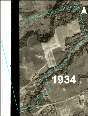
In 1996, McMaster severed what is currently McMaster Forest from the other natural lands it owned to the North and East in the Ancaster Creek and Sulphur Springs Creek valleys. The land (129 acres) was then sold to the Hamilton Conservation Authority (HCA) and the HCA incorporated the lands into the Dundas Valley Conservation Area feeder lands. McMaster retained the McMaster Forest property (then unnamed and unused).
In 2012, McMaster Biology professors Dr. Susan Dudley and Dr. Chad Harvey were tasked with creating a research space at the future McMaster Forest. In December 2012, Dr. Dudley, Dr. Harvey, and Wayne Terryberry (Coordinator of Outdoor Recreation and Natural Lands) secured a $5,000 grant from McMaster President Patrick Deane’s Forward With Integrity initiative, and $5,000 funding from the Faculty of Science to ecologically restore the property by removing invasive species and create a tallgrass prairie at the site. In 2013, they received a $140, 000 grant from The W. Garfield Weston Foundation to continue their work. This involved the removal of acres of invasive European buckthorn thickets, other invasive species removal, creation of tallgrass prairies, creation of a large 400 metre by 500 metre Smithsonian Dynamic Forest Research Plot, and the creation of a trail system on the property.
On October 22, 2015 the McMaster University Senate and Board of Governors officially designated the property as an area of environmentally significant natural land, to be used for ecologically sensitive teaching, research and recreation purposes. On this same date they approved the official naming of the property as “McMaster Forest”. The property is now permanently protected from development and will continue to be an important source of research, an amazing teaching opportunity, offer stunning recreational trails, and an incredibly biodiverse area for future generations to enjoy.
In late summer and early fall of 2021 Nature at McMaster’s Wayne Terryberry & Noah Stegman and McMaster Centre for Climate Change’s (MCCC) Dr. Altaf Arain, came together to create the McMaster Carbon Sink Forest project. With support from McMaster’s Academic Sustainability Programs Office, Trees for Hamilton, and McMaster’s Facility Services Grounds Department, a one hectare research plot was established on land adjacent to McMaster Forest. Conservationists Mark Tamminga and Bill Walker generously allowed their land to be leased by McMaster for this project. Additional support came from Guelph University’s Gosling Research Institute for Plant Preservation (GRIPP), in the form of disease resistant American Elm (Ulmus americana) trees to be included as part of the planting effort. The project will involve the planting of approximately 1100 trees of a variety of species native to the area. The trees will be monitored annually by members of MCCC for carbon sequestration and other natural asset values/environmental factors. To keep up to date on the project please visit their website here.
With a continued vision for the property and to support reconciliation, the McMaster Senate and the Board of Governors approved updated names for the property on June 9, 2022. These new names will be displayed in Cayuga, Ojibwe, and English. We thank Renae Hill and Cheyanne Herder for their time and knowledge to develop these names and translations.
NE:TOH HO GYO’TGO:T EGAHADO:DO’K – CAYUGA (GAYOGOHÓ:NO’)
MAAM-PII NAKSIN M’TIGWAAKI PANE – OJIBWE (ANISHINAABEMOWIN)
McMASTER FOREST NATURE PRESERVE – ENGLISH