McMaster Forest is host to a network of recreational walking trails that allow visitors to experience and view many different habitat types. Benches are located along the recreational trails at key lookout points or rest areas. All recreational trails are classified as moderate terrain and are mainly unmaintained and signed “Use at Own Risk”. Dogs/pets are welcome, but must be leashed at all times for the safety of your pets, other trail users, wildlife, and research projects. Biking, horseback riding, and motorized vehicles are not permitted under any circumstances. Please adhere to all posted signage and stay on trail. For a complete list of permitted and prohibited uses please see below map.
Currently the property does not have an accessible trail, but there are hopes to have one in the future.
Poison ivy, wood nettle, many thorny and bur like plants, dog ticks, and deer ticks (Lyme disease vector species) all exist on the property and proper precautions should be taken.
When winds exceed 40km/h the recreational trails on the property are closed for safety concerns.
The property is closed between sunset and sunrise.
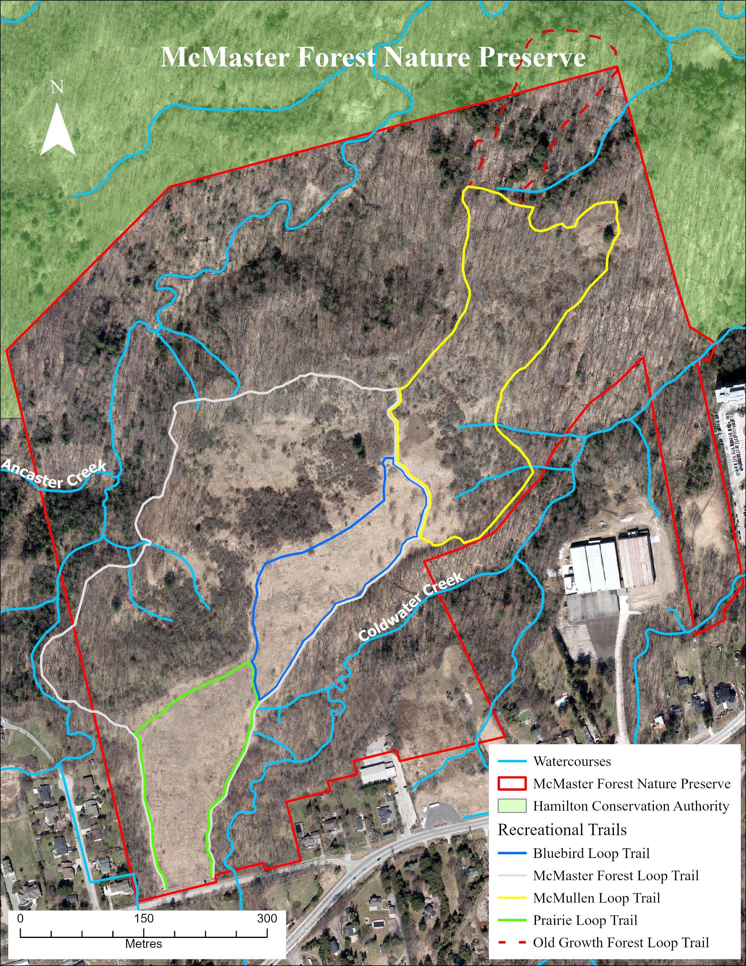
Prairie Loop Trail (0.65 km) – Green
A short flat recreational trail that features tallgrass prairie habitat.
McMaster Forest Loop Trail (1.8 km) – White
A moderate terrain recreational trail with small to moderate elevation gains featuring new growth forests and ravines, old field/meadows, and prairie habitat.
Bluebird Loop Trail (0.8 km) – Blue
A short flat recreational trail that features old field/meadow habitat and many bluebird boxes.
McMullen Loop Trail (1.3 km) – Yellow
A moderate terrain recreational trail with small elevation gains featuring new growth and old growth forests, old field/meadows, and berry thickets.
Old Growth Forest Loop Trail (0.55km) – Red
A moderate terrain, class 4, recreational trail with moderate elevation gains featuring intact old growth forests dominated by Oak and Hemlock. ***Please note due to the sensitive nature of this area no hazard tree work or inspections are completed on this trail and there is an elevated level of risk***
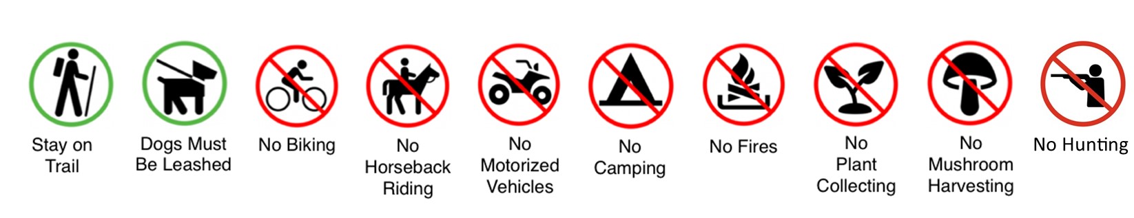
Permitted Public on Trail Uses:
- Hiking
- Dog Walking (on leash)
- Snowshoeing
- Private Nature Photography
Written Permission Required:
- Research activities on or off trail (including placement of equipment or collection of samples)
- Placement of signage
- Placement of geocaches
- Placement of any infrastructure or equipment
- Drone use
- Organized group use of the trails and/or property
- Any and all commercial activities
Strictly Prohibited Activities:
- Disturbing any scientific equipment, stakes, or flagging
- Disregarding any posted signage or closures
- Off trail recreation
- Off leash dogs or other pets
- Mountain biking
- Collection or destruction of vegetation (including plant parts, seeds, and fruits), rocks, mushrooms, and wildlife
- Horseback riding
- Motorized vehicles
- Cross country skiing
- Camping
- Fires of any kind
- Hunting
- Carrying of weapons of any kind
- Tree climbing
- Hobbyist drone use
- Metal detecting
- Dumping of any kind
- Access after sunset and before sunrise